Year 2023 Recap

Nicole, Dylan and me

Christmas greetings from Coeur d’Alene, Idaho! Wait, how did we end up in Idaho? Well one afternoon in July we asked ourselves, “What if…?” What if we could pick anywhere to live? What if we lived by the water and mountains, surrounded by beautiful nature? What if summers weren’t 110 degrees? What if we could slow down a little? We had visited Oregon, Washington, Idaho and Montana the past few summers and each visit to Coeur d’Alene kept checking all the boxes. A hidden gem (not so hidden anymore) with a stunning lake surrounded by wooded mountains and a downtown filled with charming coffee shops, restaurants and boutiques, it felt like an ideal place to live. Suddenly we came to the realization that we could alter our course and make our dream a reality. We thought about moving after Dylan finished high school, but after our visits this summer we decided to move up the timeline. We’ve only been here a few months yet it already feels like home. Maybe ask us in snowy January, but I have a feeling we’ll be just fine.

As parents, our biggest concern was switching high schools for Dylan. He was about to start his sophomore year at Granite Bay High and was well connected with a lot of friends. The safe option would’ve been to stay the course. But Dylan kept telling us how much he loved Coeur d’Alene: the lake, the mountain biking, close to skiing. At one point, Nicole and I were walking along the lake and Dylan called while mountain biking on one of the local trails. His voice full of excitement, he said “We have to move here!” So we made an impulsive decision not to wait. It never came down to one thing and I honestly thought it was such a longshot that everything would fall into place. I was reading John Steinbeck’s East of Eden and came across an unforgettable word. A single word that could change it all: timshel. In short, life is a choice and it’s not predetermined. We can change our course. We’ve done it before and we’ll likely do it again. The choice was ours and before we knew it, we said “Adios” to California and all its wonders, sold our home and moved north. We’re fortunate to be celebrating 29 years of marriage this year. In those 29 years together, we’ve moved 11 different times and we know that a forever home for us usually lasts a few years. Each experience has strengthened and fortified our bond. This move feels different, in the best way. We keep noticing a sense of peace that had been missing or was just dormant. Multiple times a day we find ourselves commenting on the beauty of our surroundings, and we truly love it here. So for now, we’ll be calling Coeur d’Alene home.

Dylan is 16 now and a sophomore at Coeur d’Alene High School. He’s loving it here and keeps busy with baseball, mountain biking and has recently taken up golf. During a baseball game In April, he dislocated his knee which ended his freshman season, but he’ll be back on the field next spring. In July he did a mountain bike race in Durango, Colorado. Since moving, he’s joined a local golf club and often plays golf after school (prior to our first snow at the end of October). Even the public courses here are pristine with pine trees and lush fairways. We’ve played some father and son rounds and enjoy sharing a few baskets of balls at the range in the evenings. I may not be able to keep up with him racing down the side of a mountain on a bike, but we can happily walk and play 18 holes together.  

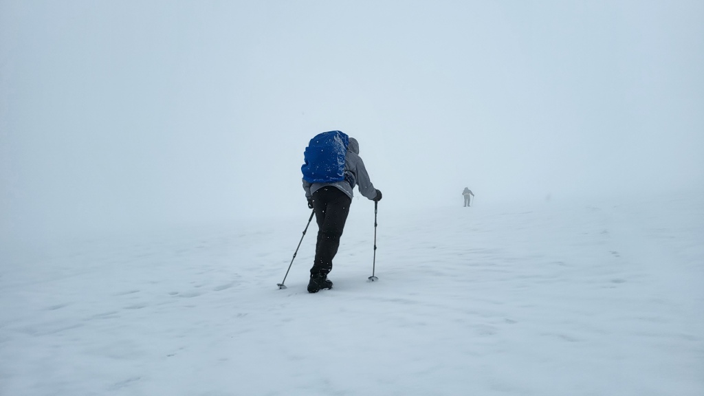
In the summer we packed our winter parkas and flew south, all the way to the southern tip of South America. Our destination: Patagonia, with stops in Buenos Aires, El Calafate, El Chalten, Puerto Natales, Punta Arenas and Santiago. We spent nearly 2 weeks there with friends flying and busing between Argentina and Chile. We fell in love with the jagged Andes Mountains that were covered in snow, marveled at massive glaciers, ate lots of empanadas, alfajores, anything with calafate berries, and Argentinian beef. We saw herds and herds of guanacos, bright pink flamingos but never spotted a puma or penguin. We may have even had guanaco meat but can’t be sure.

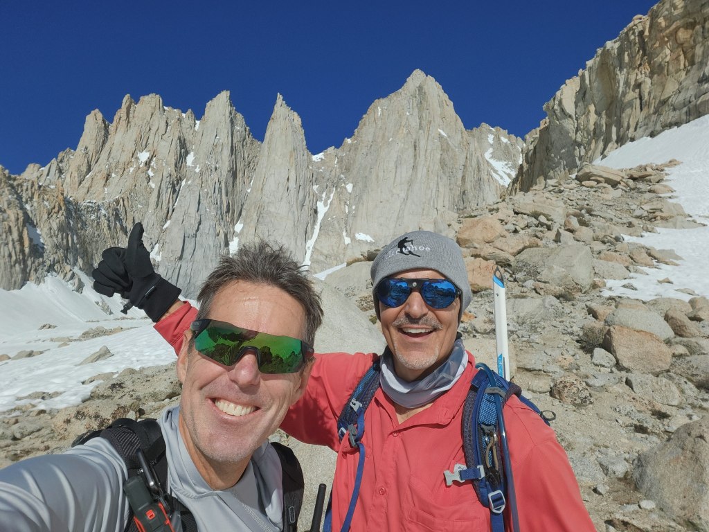
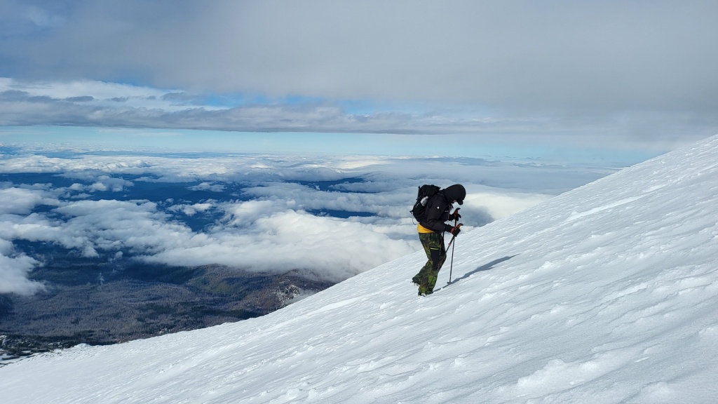
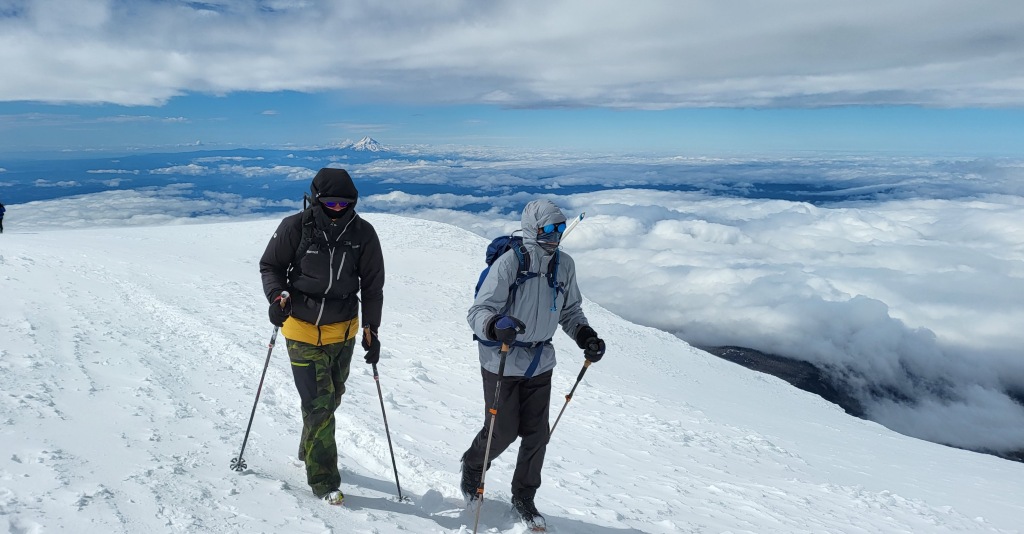
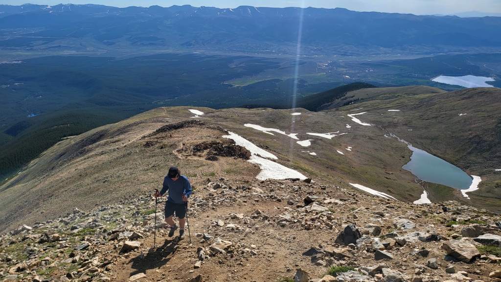
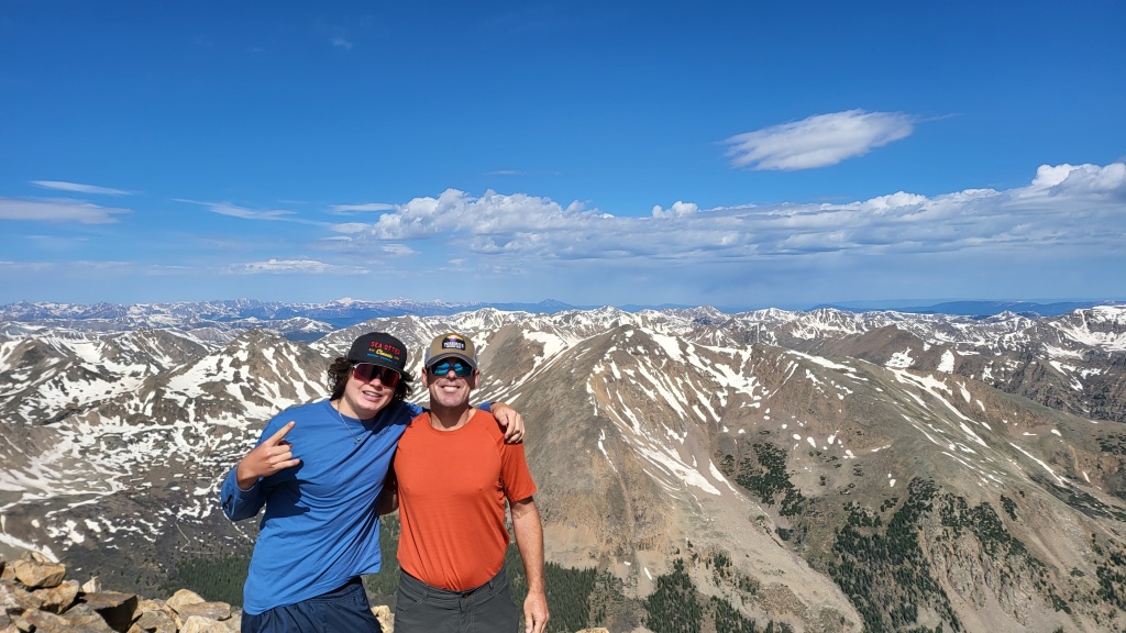
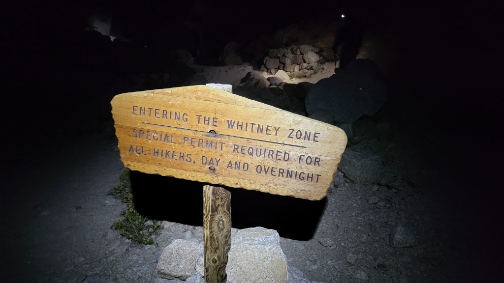
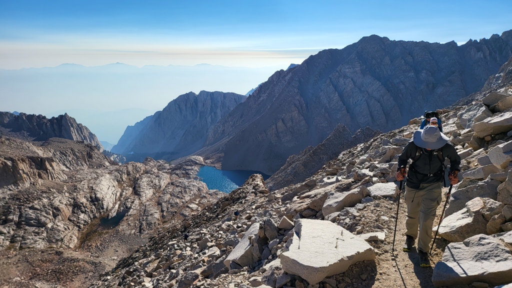
Nicole (age: N/A) has flown back to California a couple times in October and November to visit friends and do photo sessions. She’s attending a couple of Bible studies in Coeur d’Alene where she’s made new friends, and is looking forward to cozy winter days cooking and baking while it’s snowing outside. Michael (age: 53 N/A) is still keeping busy with work projects, summited Mt. Whitney again this summer, has started swinging the golf clubs again, and had a few work trips at the end of the year. Seems like there was a lot of traveling the last few months of the year, and it’s now to the point that if our dog Obi sees a suitcase come out, he stands at the front door and refuses to let anyone leave. So I think we might be happily “trapped” in our home for the rest of the year.

Well that about closes the year for us. We hope this card finds you and your home full of joy, peace, gratitude and hope, and we look forward to hearing from you. Merry Christmas!

Some of our pictures of the year.

Mt Whitney via Mountaineer’s Route

Back in February, I applied for 4 1-day permits to climb Mt Whitney. Dylan said he would do it again and whenever there’s an opportunity to climb a mountain together, it’s a no-brainer. I want to take advantage of it. A few months later, the lottery system gifted me 4 climbing permits for June 18th, Father’s Day. Then, in April, Dylan dislocated his left knee during a baseball game and he wasn’t going to be ready for hiking 22 miles so he was out. As June neared, the Sierra Nevadas were buried under record breaking snow this year and it was obvious we’d be climbing most of the mountain through snow and ice. Conditions might resemble climbing in the middle of winter rather than in the middle of June. Then we booked a family trip to Patagonia in early June (Patagonia’s winter season) and took a family vacation to Argentina and Chile. We returned home at 2 AM, June 17th. This provided just enough time to get a good night’s sleep, pack and drive down to Whitney Portal to start our climb at 2 AM June 18th.

Dan Burri joined me on this one. As we drove down together we discussed ascending the Mountaineer’s Route instead of the classic trail. John Muir first climbed this route in 1873 on his own. So it seemed with our modern technology and good conditions, it should be doable. While on vacation, I had done a little research and with so much snow it seemed like conditions on the Mountaineer’s Route would be close to ideal. I had come across postings warning the snow bridges were melting and the crossings could pose some danger. And since we would be crossing streams in the dark on an unfamiliar trail, I had some concerns. But cutting out 5-6 miles on the ascent ultimately tipped the scales in favor of the Moutaineer’s Route. I had thought we could cut at least a few hours by taking this route and summit and be back to the car by 2 PM, at the latest!

So we woke up a little after 1 AM and were on the trail by 2 AM. We chatted with a fellow hiker named George. Even in the dark his profile stood out: tall, lean and weathered a 67 year old solo hiker who left the Czech Republic 50 years ago. He told me he had scouted the trail the previous day and gave us a couple pointers on the crossings. After seeing the trail on Saturday, he was going to go with the classic trail. So after 1.5 miles, we reached the rushing North Fork Lone Pine Creek, headed up our trail on the right, and wished him luck.

Trying To Find Our Way Along The Moutaineer’s Route

The next few miles we were a couple mice working our way through a maze. There was no marked trail and any footprints in the snow blended with the sun cups. I’d head one way only to be blocked by a fallen tree left by some avalanche. Eventually we needed to cross the rushing and overlowing creek in order to reach the north side. Somewhere near 4 AM our trail ended at the flowing water and we needed to cross. A single snow bridge, about 10 feet above the water, balanced precarious before us. It was about 6 feet across yet only about 12 – 18 inches thick. I told Dan we needed to find another way. The bridge looked like it would collapse the second we put any weight on it. We walked up and down, back and forth and eventually Dan found a crossing using some branches to connect to a large boulder in the middle of the creek and then we scrambled to the other side.

Dan Climbing Up The Canyon

Once on the north side of the canyon, the trail hugged the wall. There was some scrambling as this section the trail was exposed and mainly boulders until just below Lower Boy Scout Lake. We spotted a couple lights below us moving back and forth at the creek crossing. Some other hikers were having the same problem we had finding a good crossing. After that, we never saw anyone below us so they must have not made it across the creek and decided to turned around.

From Lower Boy Scout Lake to the summit, a record breaking amount of snow buried the trail. I used my Garmin Epic 2 to navigate as well as following a good set of prints left in the snow. Our progress noticably slowed at this point. It felt like we had the entire mountain to ourselves until eventually a couple of hikers appeared descending from the summit. I was still unsure of the trail and so I asked for advice on the best approach. Dan and I took a quick breather, regrouped and made sure we were still ok to continue.

We reached the gully for the last push to the summit. The snow was softening quickly and with each step we’d sink to our knees. I started using my hands as much as my legs. It took over an hour from the bottom of the gully to reach The Notch.

Dan Climbing To The Notch

This section was both beautiful and tough. Once at The Notch, we had 2 options: take a steep coulier straight up to the summit or traverse the northwest face which would connect us to the classic trail just below the summit. We followed some prints and made our way along the northwest face. For the next 15 minutes, my heart rate spiked as I carefully watched each step. Before lifting a foot, I made sure my ice axe was firmly planted. And I desperately avoided looking down as it was a steep drop of a few thousand feet. 

We summited just after 1 PM sharing it with a few other hikers. The wind howled and we were both eager to start heading down the classic route.

Mt Whitney Summit

The 3.5 miles from the summit to the top of switchbacks always take longer than expected. I had started the morning with 1L of water and that was gone. I would not be able to refill with water until Consultation Lake. My stomach complained and my head started to ache. What normally takes a couple hours of walking the switchbacks, we glissaded in 10 minutes. At the bottom of switchbacks, Dan asked me “How much further? About a mile?” It felt cruel to have to tell him we still had about 6 miles to go. The snow was soft and we made good time descending. Just below 10,000 feet the trail reappeared and by 7:30 PM we were back at the Whitney Portal trailhead. 

Summit Picture – I’m on the left and Dan is on the right

Year 2022 Recap

Nicole, Dylan, Michael and Obi

Our biggest event this year was going back to high school. Dylan turned 15 in October and started his freshman year at Granite Bay High in August. He surprised us in the summer when he declared he was joining the freshman football team. I told Nicole it wouldn’t last. “Give it a day or two in the heat and full pads.” Yet he demonstrated incredible self-motivation and drive even when temps rose well over 100° and earned a starting role when the season began at both offensive and defensive tackle. Midway through the season he switched to tight end and played that position for the remainder of the year. Nicole and I volunteered as team photographers and usually roamed the sidelines snapping pictures during the games. Dylan is planning on spending the winter months mountain biking and backcountry skiing, and is looking forward to baseball season in the spring.

What else were we up to in 2022? We got a taste of van life. Convenient but not quite 5-star accommodations. It’s tight with one adult yet we’ve often squeezed three humans and a dog inside our little tin can while driving across the country. That describes many of our weekends in 2022. Cruisin’ for a bruisin’ was the motto because it seemed every van trip resulted in something breaking/not working. I‘ve yet to convince the family to downsize and embrace the nomadic life.

Retired yet? No, I’m still gainfully employed in 2022 developing web applications. Nicole’s photography business continues to grow and she feels blessed to work with lots of wonderful people throughout the year. Besides work and the daily routine, it felt like we were on the road most weekends. During ski season, we ventured up and down the West Coast and skied Mammoth. We thought that was the bomb until a month later we took a road trip up to Mt Bachelor, Oregon. That’s where we discovered real skiing: endless runs, giant bowls and no crowds for some of the best skiing of our lives. Come spring, Dylan raced Monterey’s Sea Otter Classic again and shocked us by winning the downhill mountain bike race. Seeing our boy raise his arms on top of the winner’s podium was an unforgettable highlight. Another spring surprise was Dylan playing on his 8th grade volleyball team and winning the district championship.

In May, the cables on Half Dome in Yosemite went up a little early and Dylan and I landed permits to climb the giant granite dome. It was one of my most memorable hikes with him as we enjoyed a 16-mile round trip trek from Curry Village to the top of Half Dome and back. At the end of May we traveled to Honolulu for our friends’ wedding. We really appreciated the downtime in Hawaii, catching up with friends and relaxing on the beach together. 

Summer was a mix of a little bit of everything. Weekends were often spent up in Tahoe with Dylan mountain biking at Northstar and maybe some trail exploring for me. In June, just as gas prices were peaking, we embarked on a cross country driving trip to Nebraska. Dylan’s baseball team played in a tournament in Omaha the same week of the College World Series, and we scored tickets to watch the Texas Longhorns beat the Notre Dame Fighting Irish. We roughed it in the van at some lakeside campgrounds (surviving crazy lightning storms and tornado warnings). Not really a vacation but it turned into a good collection of memories. Dylan’s team made it to the semifinals and Dylan had a terrific tournament. During this trip, we also knocked out a visit to Arches National Park in Utah and climbed Mt Elbert in Colorado with Dylan and Obi. I had an extra wide smile seeing Obi wagging his tail and standing on top of Mt Elbert having conquered his first 14er (a peak over 14,000’). An unexpected bonus was visiting longtime friends in Fort Collins. Walking the streets of downtown and seeing my old family home brought back fond memories of my time at Colorado State University.  

At the end of June, Nicole joined a couple of friends on a trip to Europe. They visited Milan, Venice, Lake Como, Greece and Prague. While Nicole was away, Dylan and I took a road trip and climbed Mt Adams in Washington with our adventurous neighbor. Mt Adams proved more difficult than I had expected and was probably the hardest I’ve worked for a peak. I wasn’t expecting snow in early July but it snowed as we were climbing. Good luck and perseverance prevailed and we stood together on the summit with our ice axes raised above our heads. 

Once Nicole returned, we escaped the summer heat and raced to the Canadian border, barely catching our cruise from Vancouver to Anchorage. No need to check the weather. Rain. Rain. Rain. A highlight was riding the world’s longest zipline in Icy Strait Point (spanning 1.5 miles from top to bottom). Not just known for their zipline, this area has the highest density of brown bears in the world. Yet did we spot a single bear during the cruise? Nope. Just some whales, starfish and lots of bald eagles. Dylan and I even rented gravel bikes in Skagway and rode 10 miles out of town thinking surely we’d bump into a bear. Nothing. However, after ending the trip in Seward, we did see a few bears wandering around the Anchorage area. We stayed in Anchorage a few days and had a great time connecting with my dad, brother and his family living in Eagle River, Alaska just outside Anchorage.

We enjoyed seeing so many of you this year and hearing about your life events (whether the kids are going off to college, the kids are getting married, the kids are having kids or you’ve retired, sold the house and moved in with the kids). We hope this finds you healthy, full of joy and surrounded by family and friends during the holidays. Merry Christmas! 

Some pictures of our year: https://photos.app.goo.gl/5NaqxJdv2dq72bP87

Mt Adams – A Little Bit Of Everything

Weeks after Mt Elbert, Dylan eventually forgave me for the forced summit march and it wasn’t too long before we were scouring for our next peak. This year, July 4th gave us a 3 day weekend and we didn’t need fireworks, we needed a mountain. Something somewhat close, within 12 hours or less of driving. Something that didn’t require a permit by lottery and could be climbed in a single day. Something that would still be a challenge. And just to the north of us, Mt Adams in Washington stood tall, waving its arms, screaming “Pick me!”

Mt Adams, at 12,280′, is the 2nd tallest mountain in Washington. Whereas the 14,410′ Mt Rainier is more technical with crevasses, Mt Adams can be done with a pair of crampons and ice axe. We planned to follow The South route which didn’t require any roping and didn’t contain any crevasses. Dogs are also allowed on the mountain and I struggled deciding whether or not to have Obi join us.

We were lucky to have Dan join us as we had an extra seat in the van. Nicole was travelling in Europe so it was just the boys. Friday evening around 4:30 PM, we hit the road expecting about a 12 hour drive to the trailhead. The plan was to arrive Saturday, July 2nd, late afternoon, get some sleep then be on the trail at 2 AM for an alpine start. We’d summit around 9 AM and be back to the van by noon. If all went as planned (and things usually do), we’d be back home for the July 4th fireworks.

On the drive through Oregon on Saturday we took a brief detour since Dan had never been to Crater Lake. It would only add a couple hours to drive and would be well worth it the added time.

Crater Lake

Each time I make that drive along Highway 97 and the eastern half of Oregon, I’m reminded of the beauty of those volcanic peaks. It’s not the Alps or Rockies, but they hold their own place and certainly deserve some future exploring. Dylan and I skied a couple days at Mt Bachelor this past winter. The long runs with sweeping views of The Three Sisters with just a 25 minute drive from downtown Bend is certainly tempting as a future landing spot.

All Friday and Saturday, we had been checking the Mt Adams weather forecast. Sunday kept changing from snow showers in the morning to cloudy with thunderstorms. By Saturday afternoon, thunderstorms were no longer in the forecast after 2 AM but snow showers were still likely. Not too bad and we agreed to adjust our plan accordingly. 

Just below Mt Adams, we had to make a stop at the Trout Lake ranger station. The ranger, an ederly lady, sat behind a glass window and it felt like it was her duty to discourage us from attempting the climb. Weather was not looking good, she reminded us. Looking at our van, she said the road is rough and a high clearance vehicle is needed. Likely there will be a solid ice layer on top so crampons will be necessary. We thanked her for the info and filled out our self-issued permits and headed for the trailhead. 

The road to Mt Adams

Although I think it’s less than a dozen miles from the town of Trout Creek to the South Climb Trail, it took us about 1 hour to make the drive. The last few miles, the road was slow going with numerous bumps. About 1 mile from the trailhead, there were a couple bumps the van was not going to make it over so I opted to park in a clearing. We would camp there and hike to the trail in the morning.

Our campsite about 1 mile below the trailhead

Our new campsite would add an extra 2 miles to the day. From our vantage point, we could look up and see the mountain surrounded by clouds and every few minutes a flash of lightning would light up the sky. By 9 PM, we were in our sleeping bags trying to steal a few hours of sleep. 

I woke up around midnight, looked up at the mountain and could still see flashes of lightning every minute or so. With one bar of cell phone coverage, I checked the forecast again and it still confirmed the thunderstorms would disappear around 2 AM. 30 minutes later everybody was up and by 1:50 AM we were hiking up the road to the trailhead. I had been going back and forth about whether to have Obi join us and decided to have him stay in the van. With weather below 30 degrees and climbing in ice, I worried about the exposure on his paws. He’d been fine with the length and temps, but the ice could tear up his paws. Reluctantly he stayed behind.

It took 20 minutes of walking to reach the official South Climb trailhead and we were on the trail by 2:15 AM along with a few other climbers just ahead of us. The first couple miles the trail was clear of snow. And once we encountered snow, we still didn’t need microspikes. Trekking poles worked just fine on the lower portion. We followed the existing boot tracks and headlamps above us. 

Dylan in the early morning hours

We had packed microspikes and crampons but didn’t plan to use them until around Lunch Counter. And it worked out just as planned. The trail was marked with a pole in the snow every few hundred yards. Once we knew what to look for, it wasn’t too hard to spot. Between following the climbers above us and the markers, we stayed on course and just made our way up. Once we had daylight, we could see clouds rolling in and started to feel a mix of raindrops and snow. Behind us, we had an incredible view of Mt Hood majestically rising in the south.

Dan and Dylan at daybreak

Nearing Lunch Counter, Rocky joined our expedition. Rocky was a furry St Bernard with enormous paws. Rocky would check on each of us and I started to regret leaving Obi. But when I looked at Rocky’s feet, it was clear he was built for these conditions. Whereas the ice would have likely cut Obi’s paws, Rocky had no trouble. And when he got a little ahead, he’d lie down and curl up in the snow for a quick nap. We had a few other hikers bouncing ahead or behind us and could see more climbers making their way up from far below.

At Lunch Counter, we took a break and transitioned to crampons. From this point, the hardest section was just ahead/above but most of it was lost in the clouds. From Lunch Counter to Pikers Peak (a grueling false summit), it was a lung burning, nearly 2 hour push. The entire first half we climbed in near zero visibility along light snow showers. As we neared the top of Pikers Peak, the clouds started to clear and suddenly we could see and it looked like we were going to have good views from the top.

Dan just above Lunch Counter

I kept worrying our reward at the top was going to be a view of only a few hundred feet and nothing but clouds in every direction. I swear this section seemed to go on forever. Dylan and Dan kept moving at a nice consistent pace.

Dan with Mt Hood in the distance
Dylan climbing from Lunch Counter up to Pikers Peak

I pushed ahead with one other guy and kept wondering “What’s wrong with me” as we neared the top of Pikers Peak? This shouldn’t be this hard! I would take a couple breaks, bent over at the waist and feeling utterly exhausted. But eventually, keeping it steady, we crested Pikers Peak. Dylan said his day was done as we could see the summit rising off in the distance and two lone figures making their way up. I gave him a few minutes to reconsider (which he did) and we now had a group of about a dozen climbers including Rocky all making our way up together.   

Dylan and Dan just above Pikers Peak

From Pikers Peak to the summit, the sun was out in full force. We had spectacular views all around. We could see the peak but reaching it definitely required some more work.

The view of the summit from Pikers Peak

Honestly I don’t think I’ve had to work so hard for a summit. I wasn’t expecting Mt. Adams to be so demanding. The final push was a steep short climb.

Dylan and Dan making the final push

Then, close to 11:00 AM, we had conquered the summit. To the west stood Mt St Helens and to the south we could see Mt Hood but Mt Rainier to the north was not visible. We’ll have to experience the view from the top of Mt Rainier firsthand. 

Mt Adams Summit

My estimates had been way off. I had expected to be on the summit by 9 AM and back to the van by noon. I wasn’t a few minutes late. I was a couple hours late! After enjoying about 20 minutes on top, we made our way down with most of the others. We glissaded from Pikers Peak to Lunch Counter, covering a couple thousand feet in a matter of minutes. From Lunch Counter, I jogged ahead in order to make it back to the van and Obi as quickly as possible. Just after 2 PM, I arrived back at the van and was happily greeted by my patiently waiting Obi. And less than an hour later, Dan and Dylan were safely off the mountain. 

This was a challenging climb and one that I enjoyed but underestimated. I’d probably rank it as the most difficult one so far, yet I’m sure that can be debated. From our starting location, it was 15 miles round trip. Not our longest by any stretch. We climbed 5,213 feet so not the most elevation either. But the combination of elevation and short distance in snow required a big effort. We definitely lucked out with the weather as the skies cleared for some beautiful views near the summit. 

The clock continues to tick and lately is seems to be ticking a little louder. We search for moments in life that stand out. We find ways to enjoy the journey together, put ourselves out of the normal and daily routine. Watching Dylan work his way up and not giving up on himself then celebrating with him and Dan from the top of Mt Adams was pure joy. The romantics wrote about the pleasure and pain in life, how the same experience can yield both results. And that’s it, our little adventure on July 3rd, both the pleasure and pain (more like slight discomfort). The adventurer in us seeks strength in that pain.

Side Note: On the way home, we parked and slept in the Timberline Lodge at the foot of Mt Hood. We were home in time for the 4th of July fireworks.

Squeezing In Mt Elbert

Obi soaking in the views just below the summit

Way back in 1993, I graduated from Colorado State University in Fort Collins yet never took the opportunity to climb any of the 14ers in Colorado. I don’t know why I didn’t explore some of the mountains when I was there but that was then. On a clear day, Longs Peak towers above the Front Range and can be seen from Fort Collins. Whenever I would drive to Loveland or Denver, Longs Peak stood atop the line of peaks running down the Front Range. It’s on my list and can be done in a day. And as we had a trip in May scheduled to Nebraska, I thought it might be possible to knock off Longs Peak on the way to Omaha. We were heading to Omaha for Dylan’s last baseball tournament with his travelling baseball team before high school starts. The plan: load the van with Nicole, Dylan, Obi and we would leave Friday night after work, cross the Sierra Nevadas and make it to the Utah border in the wee hours of Saturday morning. Sleep a few hours in the van and then drive 10 more hours to Colorado on Saturday and try to squeeze in a quick summit Sunday morning before driving the rest of the way to Omaha Sunday evening. A crazy plan with a 1%-2% chance of success and 98% chance of mutiny.

Looking at possible Colorado 14ers for Sunday morning that could be hiked with no special equipment, I came across Mt Elbert just outside of Leadville. Having never been to Leadville this piqued my interest right away. And I discovered Mt Elbert is the second highest mountain in the contiguous 48 states. Mt Elbert, with its 14,433′ summit, suddenly moved up the list and appeared to check all the right boxes. Fairly easy access, no permit required and we could camp in the van Saturday night next to the trailhead. Trail was clear with only a few snow patches near the summit. Dog friendly trail meant Obi could join us. 10.4 miles roundtrip implied a relatively quick hike.

So drive Friday night and into the early hours Saturday morning across Nevada, then from Salt Lake City, we would head south and connect to I-70 and drive through the Rocky Mountains. Once past Vail, we would make our way up to Leadville and eventually find the trail to Mt Elbert. Leaving after work, the drive Friday night took longer and we pulled over around 1 AM a couple hours short of the Utah border and parked between some semi trucks in a Love’s truck stop for a few hours of sleep.

5 star accomodations

We drove all day Saturday and covered the eastern side of Utah. Close to Grand Junction, we voted to take a short detour in Southern Utah and visited Arches National Park adding a couple more hours (well worth it) to our Saturday schedule.

Arches National Park

I had failed to bring any paper maps and as we pulled into Leadville, our cell phones reported 0 coverage bars and we still had another 10+ miles of driving in the dark to find the trailhead. Every now and then I’d get coverage and we’d mark our bearing to make sure we were heading in the right direction. It wasn’t until 10 PM that we found the Mt Elbert North Trail and parked the van in the parking lot along with a couple other climbers sleeping in their vehicles. As we had made our way through Leadville towards Mt Elbert, we could see the ridgeline glowing in the moonlight. It only added to the excitement and Dylan even suggested we start at midnight to be on the peak at sunrise. However, the mountain we were admiring in the moonlight was not Mt Elbert at all, but rather the mountain next to it: Mt Massive. Now not to take anything away from Mt Elbert, but if someone asked would you rather climb Mt Elbert or Mt Massive, which sounds more impressive? Exactly! But even so, we stuck with the original plan and parked at the Northest Mt Elbert Trailhead.

At daybreak Sunday, on June 12th, we made our way out of the warmth and comfort of the van to meet this Mt Elbert face-to-face. When researching options, there seems to be two common routes to the summit: the Northeast Trail and Southeast Ridge Trail. We opted for The Northeast Trail, which is the shortest at 10.4 miles roundtrip (10.4 miles according to AllTrails but 11 according to my GPS tracking) but also the steepest with an elevation gain of around 4,500′. The Southeast Ridge is a bit longer (11 miles according to AllTrails) but may be a more beautiful approach. So on the trail by 5:30 AM, the first couple miles we were under the trees and the crisp morning air kept our jackets on. Obi was happy to be joining us. We joined the Colorado Trail somewhere around the 2nd mile and another backpacker was already coming down. We asked if he had already summited and he said he was not hiking the summit. So we asked where he had started from. Mexico was his reply! On his way to Canada via the Continental Divide Trail. OK. “Have a good hike!” That quickly put the day’s effort of 10.4 miles of Mt Elbert into perspective.

Approaching the edge of treeline

The early miles were reminiscent of hiking near Tahoe. The dusty trail meandering under the pine trees. The cool, refreshing morning air stronger than a fresh cup of coffee. And as we ascended and could catch a glimpse of the mountains around us and the valley below, I realized my mistake last night. While I thought we were admiring Mt Elbert in the moonlight, it was now clear we had been looking at Mt Massive all along. My bearings of where I was, which direction I had been heading, were completely off. But somewhere around mile 3, as we emerged from the trees, we could clearly see Mt Elbert in front of us and Mt Massive right behind us.

After our Continental Divide hiker, we only crossed paths with a few other people in the lower section. Once we passed the 3 mile point and the trail opened up, we caught sight of some people coming up behind us. Also around this point, the trail steepened. Obi and Dylan were moving at a good pace but we knew the hardest part of the day was right in front of us. And so it was, the next 2 miles were unforgiving on the legs and lungs. The path was well marked with a lot of loose rocks and switchbacks to help along the steeper sections. Having both Dylan and Obi with me was what made this hike so memorable and Obi seemed to be having a good time.

I had been concerned about sharp rocks the last mile or so but the trail was completely dog friendly and Obi had no issues. We arrived at the summit around 9:30 AM. With stops it took us about 4 hours to reach the top. Views were spectacular with mostly clear skies and we could see the entire Rocky Mountain range surrounding us. Probably 15 people lingered at the summit with some having taken the Southeast Trail. We could see the Southeast Trail as it followed the ridge down to the valley. If I were to climb Mt Elbert again, next time I would opt for the Southeast route. We snapped our pictures and enjoyed a couple snacks then made our way back down.

At the summit and surrounded by Rocky Mountains

During our descent, a surprisingly large number of people were still making their way up. Even around treeline, which is probably 2 1/2 hours short of the summit, people were still heading up but some seemed to be struggling. And we encountered a number of dogs on the trail which was good to see. By noon, we had found our way back to the van and my watch showed 11 miles roundtrip. Dylan made sure to remind me again that he was not thrilled that I squeezed this right before his Omaha baseball tournament. Compared to some of our other summits, Elbert lacks certain dramatic features or challenges, yet it gave us an opportunity to experience some of the Rocky Mountains and put our name on top of a 14er. To be driving by Colorado and check off the 2nd tallest mountain in the lower 48 states would be something I would regret not attempting. And for being the 2nd tallest mountain in the lower 48 states, Mt Elbert is very doable. I think the hardest part was finding the right trailhead parking lot in the dark. Visiting Leadville and driving through the Rocky Mountains in early June proved bonuses. Now we just need to check Longs Peak off the list.

A Walk In The Park – Half Dome

Dylan just below Half Dome with Clouds Rest in the backgroud

I think we’ve been roused from our winter hibernation and the mountains came calling this weekend. Yesterday Dylan and I took a walk in the Yosemite and found ourselves on top of Half Dome by noon. Rangers installed the cables a few days early this year and on Thursday I applied for 2 permits via the daily lottery. I’ve been playing this lottery for years and had always come up empty. But I was overjoyed to receive the “Congratulations…” email on Thursday night that we had 2 permits for Saturday. Whatever was on the calendar for Saturday was going to have to wait. Our Saturday was now booked!

We left the house around 5:45 PM Friday afternoon as it was just too hard to get away any earlier. We drove about 3 hours and pulled into the Sweetwater Campround off the Big Flat Road just about 20 minutes outside Yosemite. We claimed campsite #7 as ours for the night and set the alarm for 5:15 AM in order to have a little coffee and be back on the road by 6 AM.

Sweetwater Campsite #7

It was a beautiful drive into the park as the morning sun was coming up as we decsended into the valley. It had been a few years since our last visit to Yosemite and Dylan kept saying how magical it looked. Driving past Bridalveil Falls, El Capitan and Yosemite Falls was the perfect precursor to our final destination: Half Dome.

Driving into Yosemite Valley at sunrise

We parked the van and started in Curry Village just after 7 AM and were looking up at the base of the cables by 11 AM. We followed Happy Isles across the Merced River where we then took The Mist Trail. Later in the day, this trail would be packed with people hiking to and from Vernal Fall but in the early morning it was just us and a few other hiking groups all heading towards Half Dome. After Vernal Fall it’s a short but steep hike to Nevada Falls. Once past Nevada Falls, the trail connects with the John Muir Trail and levels off as it enters into Little Yosemite.

Nevada Falls

This section was very similar to a day hike around Lake Tahoe with the crush granite sand and pine trees. As we started to approach the backside of Half Dome, we could see Clouds Rest just a few miles away. We had hiked Clouds Rest a few years ago so it’s been fun to connect the dots each summer. We stopped and had lunch a little below the base of Half Dome. I had only packed 2 sandwhiches and a couple granola bars so lunch was our final meal til we could be back to Curry Village. A couple of rangers were seated next to the trail just below Half Dome and checked our permit. Off to the side, some hikers were asking if we had any extra spots on our permit so they could join us. But our permit only allowed the 2 of us. We took a few minutes to put our gloves on before starting to ascend the cables.

Dylan and me at the base of Half Dome

It felt a little crowded on the cables with some climbers already descending and many others still going up. A few hikers were clipped in to the cables but most of us just used our hands, gripped the cables and pulled ourselves up. We were so close but about 1/3 of the way up the cables Dylan turned around and said he didn’t want to go any further. I took a deep breath and said just relax we are almost there. Another hiker was descending and was right above Dylan and spoke up, reassuring Dylan: “Hey, you got this. The hard part is done and it will be worth it.” I didn’t have to push. That was it. He kept going and a few minutes later we were on top.

Every experience in the mountains has its own unique stamp. As we made our way back we talked but I began to notice Dylan would keep pulling ahead. I wasn’t struggling. He was getting strong. Other than the brief doubt on the cables, there were never any meltdowns. I looked up, and could see him pulling away just a few feet ahead. The song Kite from U2 started to play in my head and the lyrics suddenly took a new meaning for me:

I want you to know
That you don’t need me anymore
I want you to know
You don’t need anyone or anything at all

Who’s to say where the wind will take you
Who’s to say what it is will break you
I don’t know which way the wind will blow
Who’s to know when the time’s come around
Don’t want to see you cry
I know that this is not goodbye

I will be dad for the rest of my life. How lucky am I to have days like this with my son just to wander amongst the mountains on a Saturday. However, I realized on this particular Saturday I was witnessing the transformation of my little boy into a man. He’s starting to find his own way, his own path and direction. And he’s going to be just fine.

From the valley, it ended up being about 16 miles with 5,000 feet of elevation gain. Other than the birds ransacking Dylan’s pack on the summit while we sunbathed and not packing enough food for 16 miles, it was a very rewarding day with Dylan in mountains.

Year 2021 Recap

Nicole, Michael and Dylan

This year we could easily be writing to you from another state as we debated joining The Great Resignation and Great Migration by moving out of California (Idaho and Washington were at the top of the list). But the first U-Haul wasn’t available until 2022 and we’ve heard rumors that California will soon be paying current residents NOT to move out of the state 😉 so we’ll probably give it a few more years. One of our greatest joys has been traveling and experiencing new things. We’re not sure we’ll ever settle down in one place forever. The more we travel the more we realize how much beauty exists beyond our bubble. But for now we’ll keep our heads down and keep living the “California Dream” while we monitor the PMI index so we know when it’s safe for us to venture outside.

I’ll skip the work updates other than there’s always a lot of work to be done. What can be more exciting than coding in Angular and Typescript? I was lucky enough to lead some neighborhood hikes throughout the year as we introduced new friends to some of the local trails. Dylan and Obi were regulars and I even coerced Nicole to join us on one of my favorite hikes in Tahoe along the Pacific Crest Trail to the top of Castle Peak. I could go on and on about our outdoor adventures but let’s move along and on to more exciting updates about Nicole and Dylan.

Nicole’s senior portrait photography business is thriving and she’s blessed to have a job she loves. We try to use her downtime to travel together (mainly road trips). In September, Nicole was able to visit friends in the Czech Republic and Austria. Dylan and I barely survived the week on our own. “Dylan, this is probably safe to microwave, right?”

Speaking of Dylan, yes he’s still at home. At 14 years old, we had high hopes he’d be supporting himself by now with income from his YouTube channel – but it looks like that dream is still a few years away from profitability. Besides watching and posting mountain biking videos, he discovered backcountry skiing this year. Visions of epic powder skiing down huge untamed peaks were quickly dashed when we realized how much work is involved in the uphill portion. No chairlift or gondola to get to the top – you actually have to climb up the mountain on your skis. Not to mention the other dangers, like losing your partner in 5 feet of fresh powder. Obi joined us for some spring skiing and couldn’t have been happier running through the snow chasing Dylan. Fingers crossed this winter brings lots of snow.

In April, Dylan took the plunge and was baptized, publicly committing his life to following Jesus. This was a big step as we continue to watch him grow into a young man. In August, he started 8th grade at Cavitt Junior High and now he’s able (although not always willing at 7 AM) to ride his bike to school along the Folsom Lake trails. He continues to play baseball and many of our weekends are spent at tournaments. Dylan’s also on the basketball team at school and still plays the drums. Lots of irons in the fire. If there’s one thing Dylan is always excited to do, it’s ride his mountain bike – you’ll find him riding at Folsom Lake and racing at Northstar every chance he gets. In October, we spent a weekend in Monterey at the Sea Otter Bike Classic where Dylan competed in the downhill race. As far as cycling goes, our roles have reversed. If I have a mechanical question about my bike, Dylan has the answer and knows way more about bikes than I ever have. Now when we go to the bike shop, Dylan asks the questions and I stand off to the side, slowly nodding and pretending to follow the conversation. 

Even with everything going on, we had some fun family getaways in 2021: In April, we boarded a plane for the first time since the pandemic to vacation in Hawaii. It felt great to relax as a family. We walked miles every day and enjoyed afternoons at the beaches playing in the surf. In July we packed up the Jeep and headed north for a driving trip through Oregon and Washington, visiting Bend, Leavenworth, the Seattle area, hiked The Enchantments and drove back along the beautiful Oregon coast. In August, we did another road trip: Twin Falls and Craters of the Moon in Idaho, Yellowstone in Montana, Grand Tetons in Wyoming and Park City in Utah. At the end of August we still had one more mountain to climb: Mt. Whitney. I was beyond proud to see Dylan reach the summit of Mt. Whitney (the highest mountain in the lower 48 states) and we completed the 22 mile trek in 16 hours. It was a great way to cap off our annual mountain adventures.  

It’s been wonderful to connect with many of you this year. We hope this card finds you healthy, full of joy and surrounded by family and friends during the holidays. Merry Christmas and we hope to reconnect in person in the new year. In fact, we may be coming to a town or campground near you as we join the #vanlife crowd in 2022!

Mt Whitney

Our group passing through Trail Camp at 12,000 feet

Sharp, knife-like ridge lines have surrounded us. Under the faint light of our headlamps, we’ve been climbing and crossing countless boulder fields the past few hours. Ahead we can see it, endless drop offs that’ll make us feel like we’re on top of the world. Yet we’re barely halfway there. Look down and it’s a long way down. Look up and there are still hours and miles to go. And it’s only 6 AM. The sun is just coming up and today the morning light tastes better than a hot cup of coffee against my chilled lips. Rising in front of us, the notorious 100 switchbacks. We take a few minutes to try and consume some calories. At 12,000 feet elevation, the head and stomach are starting to complain. The hardest part isn’t going to be the summit. The next 1,500 feet and 100 switchbacks are the real test. The steepest section of the route stands directly in our path. The switchbacks relish in their task: grind you down for the next 2 hours and send you whimpering back down the mountain with your tail tucked between your legs.

Last year, we had a permit to climb Mt Whitney on October 22, 2020. But the California fire season shut down Mt Whitney and the surrounding trails in early October. There was never a fire on the mountain or even very close. But California has now taken the approach of when in doubt, shut it down. So we struck out in 2020. Again, I applied for day permit for 2021. In 2019, you had about a 34% chance of obtaining a permit. I’m sure the odds are now even lower with more people heading outdoors. However, Lady Luck smiled down on me again and I received an email notifying me I had been granted a permit for Friday, August 27th. The climb was on for 2021.

It had been 12 years since I had climbed Mt Whitney. The last time, Dylan was not even 2 years old. This time, Dylan would be joining me on the climb. 12 years earlier Jody and I had summitted together with a few other friends. This time, Jody, MJ, Dan, Shane and Shane’s friend Nick would all be part of the group. It’s doable to complete the 22 mile roundtrip hike in a day but it can be a long day. The plan was to start at 2 AM, reach the summit no later than noon and make it back to the trailhead by 6 PM. Weather forecast promised blue skies and a gentle breeze. No threat of thunderstorms so we couldn’t have asked for better weather.

Dylan left school at noon yet I couldn’t escape work until 3 PM. We were on the road for 20 minutes when we realized we left all our CLIF BLOKS back home. So we made a U-turn and headed back home to see what else we might have forgotten. The Caldor fire near South Lake Tahoe closed Highway 50. This meant an additional 45 minutes of driving as we had to drive around the north shore of Lake Tahoe where we’d connect to Highway 395 in Carson City. We had at least 6 1/2 hours of driving ahead of us. Sure enough, about 7 hours later around 10 PM, we pulled into the Whitney Portal campsite and parked next to Dan’s car. We brought our 2-person tent but since we would be getting up in just a couple hours, decided to put the seats down and sleep in the back of the Jeep. I don’t think I got more than 30 minutes of sleep. Some of the other campsites started buzzing around midnight and some hikers were opting for a midnight start. Just like we drew it up, at 1 AM the alarm sounded. We got our gear ready, drove the 5 minutes up the road to the trailhead and were on the trail at 2:13 AM.

Entering the Whitney Zone

For me, hiking in the dark between midnight and sunrise usually borders on the surreal. I do plenty of running with a headlamp in the dark alone, but hiking up a mountain with 7 friends at 2 AM under the stars feels more like an expedition, better yet a journey or even an unforgettable life experience. But before we could actually start, we had to weigh in. A scale hangs next to the start of the trail and it’s customary to weigh your pack. Who didn’t pack enough? Who packed too much? The scale will reveal all. I think our group ranged in weight from 10 lbs to 28 lbs. Unfortunately for me, I took first place with the 28 lbs for the most weight (4 liters of water and 2 Gatorades for both Dylan and me, snacks and too much technology). If someone needed their battery charged, a second camera, backup headlamp, satellite communicator, I was prepared. The 30 lbs I had been able to lose in the previous 8 months, now were stuffed in my backpack and on my shoulders. My knees would not be thanking me by the end of the day.

The early hours passed quickly. We hiked in the dark the first 4 hours. At one point, we missed a turn, lost the trail and scrambled down to what looked like the trail. A few minutes later, someone’s GPS confirmed indeed we were back on the trail. We continued on but noticed we seemed to be descending instead of ascending. No worries someone said, this part heads down to the lake. A few minutes more passed and I realized the section looked awfully familiar. Sure enough we had just climbed this same section 15 minutes earlier. Lost in the dark, we were heading back down the trail we had just climbed. We were on the right trail just heading in the wrong direction! Luckily we corrected our mistake and made a quick U-Turn.

Dylan taking a breather

Those first 4 – 5 miles can be scenic as you make your way up. There are still pine trees and a couple of lakes. But all of that was wasted on us as we couldn’t see a thing in the dark. Yet we seemed to be making really good time. It wasn’t until daybreak that we could begin to appreciate the views. The morning light would bounce off Eastern facing rock walls. For a few minutes, the mountains in front of us looked to be glowing as the sun started to come up behind us.

After 4 hours and 6 miles of climbing, we reached Trail Camp which is at an elevation of 12,000 feet. The energy was dipping and we still had the most difficult section coming up next: the 100 switchbacks. I don’t think there are actually 100 – more like 97 according to some. But I wasn’t counting. I just know there are a lot. A small lake sat just below this section and marked our last water source until we would return to this spot some 10 miles later. Going up, mentally this was the hardest part for Dylan. He started to develop a headache and was probably having some issues with the altitude. I’m sure it was impacting everyone. Jody had just had surgery on his jaw a few days earlier and was experiencing some pain at this point too. Advil to the rescue.

Dylan making his way up the switchbacks

One of my favorite views of the climb is not necessarily from the summit but from the top of the switchbacks. The trail slips through a crack in the ridge at around 13,500 feet and follows the western side of the ridgeline. When you pass through the crack, you are standing thousands of feet above a vast valley below of wilderness, alpine lakes and the first section of the John Muir trail. It’s a breathtaking reward for overcoming the switchbacks. From here, we could probably spot our steps last summer when we backpacked the Rae Lakes Loop.

The view after the switchbacks looking towards the John Muir Trail

From the top of the switchbacks, there are still another 2 miles to go. You’d think it would be just around the corner but they didn’t want to make it that easy. There was very little climbing over the next mile as the trail follows the ridge line north. The group seemed to split and we fell into a couple smaller groups. Dylan and I hiked with Jody and MJ. Shane would join us every few minutes. Dan and Nick both seemed to be comfortable on their own. Eventually, the summit comes into view and you can spot some people on top and the small rock hut sitting just below the summit. I took my time the last few hundred yards while Dylan raced ahead. It felt like that last half mile would never end. But it did and suddenly we were standing on the summit of Mt Whitney at 14,505 feet a little after 10 AM. Although based on our signs at the summit there seemed to be a debate as to the official elevation.

While on the summit, we huddled inside the stone hut. Ate some snacks. Took some pictures from the summit and just closed our eyes and let the sun warm our faces. As I took a few minutes to nap on a large rock, I could hear some people were making phone calls. I pulled out my phone and sure enough I had 5G coverage. So I called Nicole and let her know we had made it and were doing fine. She said she knew because Dylan had just called her! Taking our time, finally just after 11 AM, we gathered our packs, took a few more parting pictures and began to make our way down. By 6 PM, we were back where we started at the trailhead. 22 miles but felt like more (and harder than I remembered) but so glad to have done it again.

Dylan and I standing on the summit

Here’s the data from my Garmin watch: https://connect.garmin.com/modern/activity/7382915831?share_unique_id=8

Some more pictures are available here: https://photos.app.goo.gl/ve3J86jX3TXC7rvr8

And here’s a short highlight video of the day:

The Enchantments

Colchuck Lake with Aasgard Pass and Dragontail in the distance

During the 2020 quarantine, we added two more destinations to our bucket list: Leavenworth, WA and The Enchantments. They both happened to be in Central Washington and, as luck would have it, they were just minutes apart. But visiting them meant at least a 13 hour drive each way from our home in Granite Bay, CA. The Enchantments is a very popular hiking area and nearly impossible to score an overnight camping permit. We decided to attempt the entire trail in a day, which is possible just not necessarily advisable. The official distance listed on the Washington Trails Association website (https://www.wta.org/go-hiking/hikes/enchantment-lakes) has the point-to-point hike at 18 miles. Most reports from other hikers using GPS show 20-22 miles. I thought both sounded too far and estimated a more manageable 17 miles.

So we used the July 4th holiday to make a family trip up through Oregon and into Washington. On Thursday, I stopped working around 3 PM and we loaded the Jeep and hit the road for Bend. A number of forest fires were burning along I-5 near Mt. Shasta and the fastest route to Bend, along Highway 97 was closed. The firefighting planes were literally dropping fire retardant on I-5 to prevent the fire from jumping the interstate. What should have been about a 7 hour drive from our house to the first stop, ended up being more like 9.5 hours. We drove in the dark from Medford to Bend, but would love to make the trip again in the daylight as it looked very mountainous with dense forests as we zipped along the Rogue River.

The next day we cruised the downtown streets along the older section of Bend and also made a quick trip to REI for last minute supplies. Then we continued our drive north to Leavenworth. The drive along this part of Oregon, taking Highway 97 north, is pretty spectacular. 8 months ago, we had never been to Central Oregon. But we’ve now made 3 different trips there all in the last 8 months. And each time we like the area more and more. Driving north, the snowcap peaks of Mt Bachelor, The Sisters, Mt. Washington, Mt Hood and Mount Adams all sit off in the distance to the west. As we drove, it’s a remarkable sight as we made our way along the high desert but saw the peaks on the horizon reaching up to 12,280′ and still covered in snow in July.

Mount Adams in Washington

We stopped for lunch along the Columbia River and reached Leavenworth by late afternoon. The town really does resemble a small Switzerland, Austrian or German village nestled against the mountains. We walked the streets and had dinner outside. There was even a Starbucks in town but you would never know as it was styled like all the other small Bavarian shops and restaurants. Visiting this place during Christmas with snow covered streets must be magical. By early evening, we were back in the Jeep and made the 20 minute drive east to Wenatchee, where we had booked a room for the night.

Leavenworth, Washington

The alarm clock sounded at 4 AM and we were up in a matter of minutes. We opted to take the “easier” hiking route, starting from the Stuart Lake trailhead and finishing at the Snow Lakes Trailhead. Easier? Primarily because all the hard, uphill climbing is done in the first half and we could mainly descend the second half of the day. It’s a point-to-point hike and requires a shuttle. Nicole would drop us off at the Stuart Lake Trailhead, about 40 minutes from Leavenworth and up a rough, back wrenching, dirt road. Then she would meet us about 20 miles later at the Snow Lake Trailhead, only 20 minutes outside of Leavenworth. We scheduled a 4 PM rendezvous. Well, that was the plan anyway.

From our hotel in Wenatchee, it took about 1 hour to reach the drop off point. There were probably 30 cars parked at the trailhead and no more empty spaces when we pulled into the parking lot at 6 AM. We covered ourselves in bug spray and sunscreen, issued ourselves a day use permit, said our goodbyes to Nicole and were heading towards Colchuck Lake a few minutes later.  Would have loved to take Obi with us but, first dogs are not permitted in The Enchantments and some of the boulder scrambling would have been a challenge for him.

The first couple hours hiking to Colchuck Lake we followed the well marked trail through the mosquito infested forest. Mosquitos were everywhere! But the sounds of flowing water to our right from Mountaineer’s Creek kept us relaxed. Occasionally there would be an opening in the trees and we could catch a glimpse of the valley walls surrounding us. You have to ascend 2,280 feet to reach the lake so most of the time you are climbing. We passed some other hikers on their way up to the lake and were passed by a few others doing the entire route like us. It seemed to be farther than the advertised 4 miles but we eventually reached the lake. In my 50 years on this earth, I don’t think I’ve seen a more magical alpine lake setting than standing on the edge of Colchuck in the morning and looking across the azure waters and up at Aasgard Pass and Dragontail. We took a few minutes to soak in the masterpiece before us, but knew the biggest climb of the day was up next.

The trail followed the edge of the lake while we made our way to the far end. It was easy to lose the trail as the trail entered the bottom of Colchuck Glacier and we jumped from boulder to boulder, every now and then spotting a cairn (rocks piled on top of each other to mark the trail). The path around the lake provided us with so many incredible views. Even if you don’t have the desire to hike the entire Enchantments, just seeing Colchuck Lake is worth the price of 4 miles up and 4 miles down.

But we knew it was going to cost us a little more in order to reach the upper Enchantments and that required a pretty hard climb up Aasgard Pass. Everything we had read warned us to stay left, especially if there is snow and ice as you could be climbing right on top of a waterfall. But there was very little snow and there were enough other hikers ahead of us that we could spot a few of them as they made their way up.

The boulder scramble up to Aasgard Pass

And it was during this climb that we spotted our first mountain goat, standing just a couple dozen feet away from us. Like us, the mountain goat stood atop a boulder admiring the view. I abandoned the trekking poles and was using my hands more often than not to grab a boulder. Dylan preferred to climb with his trekking poles. To each his own. It took a couple thousand feet to climb to Colchuck Lake and then another couple thousand feet more to climb Aasgard Pass. Remarkable to gaze back and consider it was only a few hours ago that Nicole dropped us deep in valley that we could barely now see.

Looking down at Colchuck Lake

We took a short break at the summit (7,800 feet) and were greeted by another mountain goat and her baby as they strolled by us.

Baby mountain goat keeping an eye on us

We had reached the Upper Enchantments. In many ways, it reminded me of Desolation Wilderness near Lake Aloha. It resembles a moonscape: barren fields covered only in rocks and scree dotted with ice filled azure lakes. At the top of the pass, other hikers basked in the sun and a few rock climbers made their way to Dragontail. Every few minutes, we would pass a couple mountain goats feeding on small patches of grass on the edge of the water.

This section was enjoyable on many levels. Water flowed everywhere, connecting many of the lakes. There was still a lot of snow and the views were in every direction. Seeing this with our own eyes and seeing it together was worth the effort. At this point, our water bottles were dry so we used our water filter to refill from one of the lakes.

Pass through the Upper Enchantments

Always the eternal optimist, I entertained the thought at this point we were about halfway done. Not even close! But there was no complaining. The scenery was too spectacular not to enjoy as we strolled from lake to lake. I can’t put a name to all the lakes we passed but they were all crystal clear and many with waterfalls flowing into or out of the lake. If we lived near these mountains, I envision spending a lot of summer days exploring.

For the next few hours, we hiked mainly by ourselves. We crossed paths with what appeared to be another father/son duo (with the son in his early 20’s) and one other couple. We were all heading in the same direction and enjoying our own journeys. With no cell coverage, I sent Nicole a message using the Garmin InReach Mini letting her know we were probably a couple hours behind our 4 PM predicted finish. The InReach Mini is a small device that I now carry with me whenever I’m in the backcountry. With just a couple button presses on my watch, I can send/receive messages using the Iridium satellite network. I can be just about anywhere in the world and send her a message that includes my location. In case of an emergency, we could also use the SOS feature to summon emergency help. Probably overkill for most of our adventures but a nice safety device.

One of my favorite sections in the Lower Enchantments was hiking along the shore of Leprechaun Lake. There were some snow bridge crossings, some more scrambling, some glisading, some moments where we just stopped and tried to take in the view and moment. Eventually, we reached a vista point near the far end of Lake Viviane.

A few minutes later, we were surprised to see a ranger that was checking for permits. We could see the Upper Snow Lake way down below us. When I asked the ranger how much farther to the Snow Lakes Trailhead, he hesitated. Not quite sure, he estimated about 1.5 more miles to Upper Snow Lake, then between 5 and 10 miles to the trailhead. “Hey Dylan, only 6 1/2 more miles!”

Upper Snow Lake sits way down below

It was a pretty tough and rugged descent down to the Upper Snow Lake. We lost the trail a few times and did more sliding than hiking. It was steep and sometimes it was too steep to go down along a sheer granite wall so we traversed side to side. Eventually we reached the first valley floor as the trail slipped under the shady protection of a thick forest along the edge of Upper Snow Lake. Our pace quickened as the trail was either level or descending slightly. More than once, Dylan wished he could bring his mountain bike and ride the trail through the lush landscape floating over the twisted tree roots snaking along the floor.

The last few miles were a combination of endless switchbacks and a view of the parked cars waiting in the parking lot below us. We could see we were close but it seemed to take forever to cover those last few miles. Long past our 4 PM anticipated finish, we finally crossed over the Wenatchee River bridge and arrived at Snow Lake Trailhead around 6:30 PM where Nicole was waiting.

Wenatchee River at Snow Lakes Trailhead

Our bodies done for the day, we climbed into the Jeep and Nicole drove us into Leavenworth for a well deserved round of milk shakes at Heidleburger Drive In. Then it was off for a couple nights in Seattle and then driving home along the Oregon Coast.

It Takes A Village To Push These Products Out The Door

I’ve been fortunate to work on some pretty exciting and rewarding projects. For the past few years, I’ve developed and worked on software that was used by millions of people these past few weeks. If you worked at a Polling Place/Voter Center in one of these California counties: Los Angeles, San Diego, San Bernardino, Nevada and a few others, you may have used “Panorama” to check/register voters. I prefer my products to have code names, usually after mountain peaks. So I called it “Panorama” and it stuck. “Panorama”, the highest point in flat Nebraska, was something I developed and it first launched in Nevada County, CA in the 2018 election. It now belongs to another company but I learned it was used in the 2020 General Election in a number of California counties. The other product is something I’ve been working on the past 2 years. It takes a village to get these products out the door. If you live in Alabama, Arkansas, Delaware, Kansas, Nebraska you would use it to check your registration and/or ballot status online. I didn’t have the opportunity to name this one so it goes by the name VoterView. You can search for it online and it’s usually on your Secretary of State’s website. There’s other projects but these have been my favorite so far. It’s been a crazy few years. 5 years ago I took a chance and walked away from a successful career. I wanted to pivot. Learn something new. I could have stayed on the sidelines. But I find it’s better to still be in the game. Make no mistake, most days we’re hustling. My life is never a straight line from Point A to Point B. But every now and then, it’s good to look back and see how many twists and turns you took and eventually, miraculously, you made it. Once at Point B, you discover Point C is around the next bend. Now onto the next thing.